On the Trail
For the most waterfalls on a moderate hike, this loop can’t be beat. It includes 620-foot Multnomah Falls, rapids and smaller falls on Multnomah Creek, and the tumbling, gradual descent of Wahkeena Creek, culminating at 242-foot Wahkeena Falls. The best time to hike this very popular loop is in spring when the creeks are at maximum volume. Start the 4.6-mile loop at Multnomah Falls to leave behind the crowds after the first mile of the hike. From Multnomah Falls, the elevation gain (and loss) is 1,700 feet.
Permits & Pets
Timed use permits are required at the I-84, Exit 31 parking lot from 9 a.m.-6 p.m. May 26-Sept. 4. Timed entry offers a one-hour time slot for arrival, but visitors may stay as long as desired.
Obtain timed use permit: via Rec.gov (can reserve up to two weeks prior) or U.S. Forest Service.
The U.S. Forest Service administers this site. No permits are required. Dogs must be on leash.
Trail Notes
- Take a photo of the map of this loop at Multnomah Falls Lodge. From the lodge, walk to the overlook below the lower tier of Multnomah Falls, which drops 69 feet. Then follow the paved trail (Larch Mountain Trail/Trail 441) up to the Benson Bridge.
- Beyond the bridge, the trail switchbacks steeply uphill. In 1.1 miles, turn right onto a spur trail to the viewpoint atop Multnomah Falls’ upper tier. It leads to a wooden overlook that’s thrillingly close to where the upper falls begins its 542-foot drop. (The total drop is 620 feet: 69 in the lower falls, 9 feet between the falls, and 542 feet for the upper falls.)
- From the falls overlook, come back to Trail 441 and turn right. Immediately cross a bridge over Multnomah Creek, and follow the trail along the creek’s west bank, passing a series of small waterfalls.
- At a signed intersection with the Wahkeena Trail (Trail 420), turn right. The trail climbs gradually, and in about 0.7 mile crests at a prominent junction with a visible sign. (This is just beyond the intersection with the Devil’s Rest Trail [Trail 420C], which turns left, heading uphill.) At the junction, go straight (i.e., take the left trail, Trail 420).
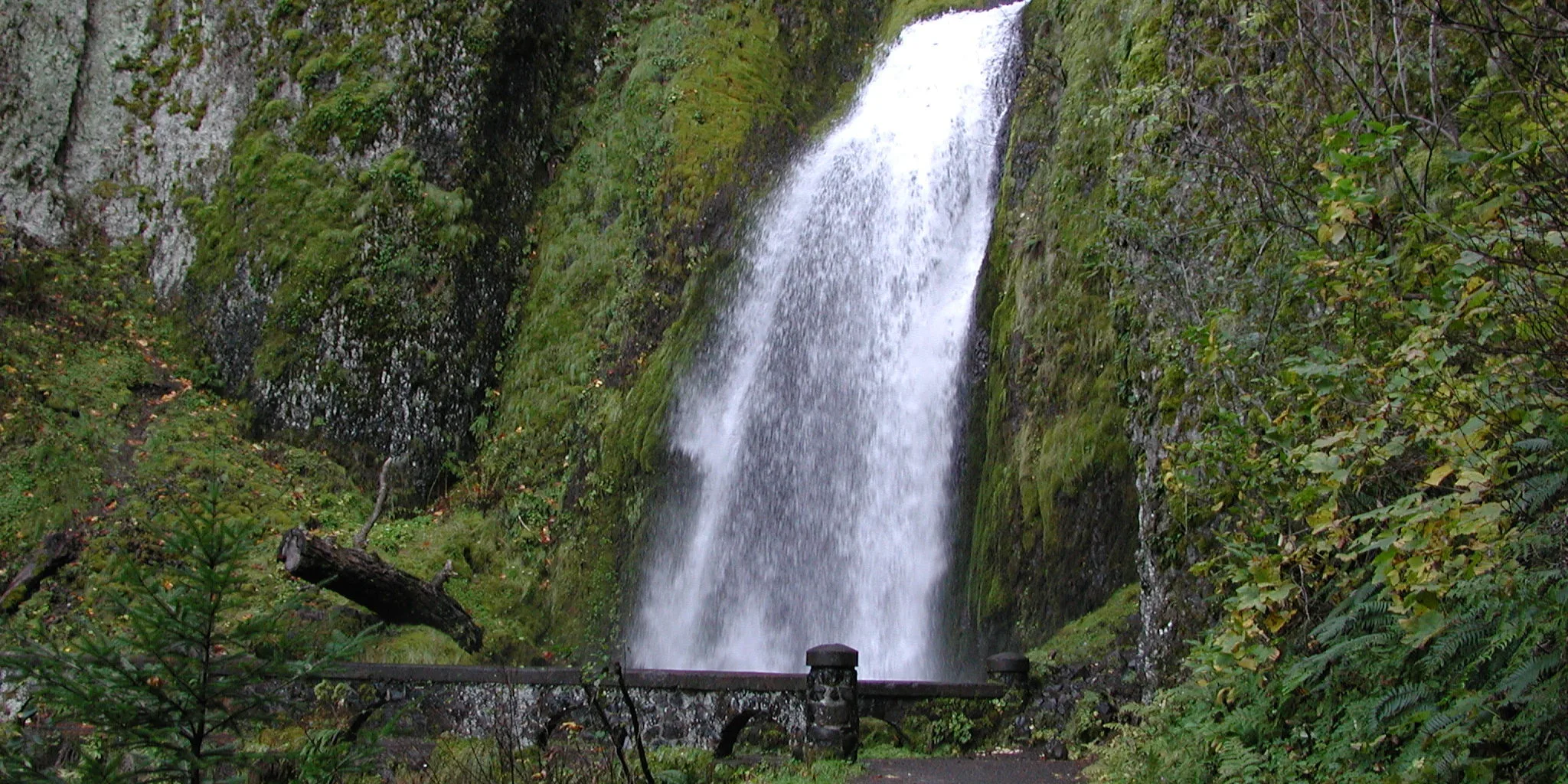
- Follow Trail 420 gradually downhill about 0.3 mile. At an intersection with the Angel’s Rest Trail (Trail 4150), you’ll be turning right, staying on Trail 420. But before you do, walk about 0.1 mile on Trail 4150 to see the birth of Wahkeena Creek, a spring where it emerges, with gusto, from the earth. After looking over the springs, come back to the junction and walk downhill on Trail 420, along Wahkeena Creek. After about half a mile, cross a tributary stream at sparkling, much-photographed Fairy Falls.
- Continue downhill and cross Wahkeena Creek twice on small bridges. Then the trail peels away to the east (and becomes paved), switchbacking down to the base of Wahkeena Falls. Cross a stone bridge before winding down to the parking area.
- From the base of Wahkeena Falls, follow the Return Trail (Trail 442) east 0.5 mile back to Multnomah Falls. This trail rolls up and down, just above the Historic Highway, and is certainly the least interesting part of the loop. Do not walk on the busy and shoulder-less road.
- Please always stay on the trail and clean your boots before and after you hike. Hikers are a common vector for spreading invasive seeds.
- Restrooms are available in Multnomah Falls Lodge’s lower level.
Friends of the Columbia Gorge does not track trail closures. If you are planning a hike in the Gorge, please check other sources in advance for the latest updates, including the U.S Forest Service, Ready Set GOrge, and AllTrails. Recreational activities in the Gorge can involve risk of injury, death, property damage, and other dangers. Friends does not assume responsibility for any such outcome resulting from the use of the information on our hiking web pages. Your use of these web pages is strictly at your own risk.
Post-Hike Explorations
Spend some time learning about the waterfalls in the Gorge in the Multnomah Falls Visitor Center. It’s jointly staffed by the all-volunteer Friends of Multnomah Falls and the U.S. Forest Service. In the adjacent gift shop are books and maps, along with souvenirs.
Other Hikes from This Trailhead
- Multnomah Falls
- Multnomah Falls to Franklin Ridge Loop
- Multnomah Falls to Devil’s Rest
- Multnomah Falls to Larch Mountain
Directions & Travel Tips
East- or westbound I-84, get in the left lane to take exit 31/Multnomah Falls. Park in the large lot between I-84’s east- and westbound lanes, and walk under the freeway and on the paved walkway along Multnomah Creek to Multnomah Falls Lodge. Restrooms are in its lower level.
To approach Multnomah Falls from the Historic Columbia River Highway (not recommended during busy seasons, as traffic can slow to a crawl), if westbound on I-84, take exit 35/Ainsworth and drive 4 miles west on the Historic Highway to the lodge. Parking is very limited along the Historic Highway. Eastbound on I-84, take exit 28/Bridal Veil and drive 3 miles east on the Historic Highway to Multnomah Falls. (View current parking lot capacity.)
Car-Free Travel
The Columbia Gorge Express shuttle stops at this location. Click here for schedule and fare information.