Timed use permits are required at the I-84, Exit 31 parking lot from 9 a.m.-6 p.m. May 26-Sept. 4. Timed entry offers a one-hour time slot for arrival, but visitors may stay as long as desired.
Obtain timed use permit: via Rec.gov (can reserve up to two weeks prior) or U.S. Forest Service.
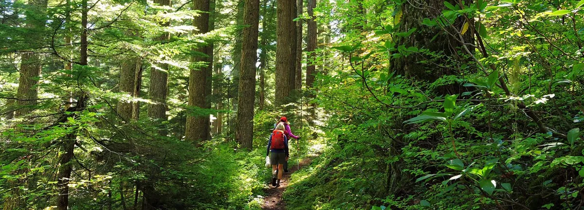
This hike begins from the Multnomah Falls parking lot (view current parking lot capacity), accessible from either I-84 or the Columbia River Scenic highway. It is a favorite of many for its accessibility, for the spectacular viewpoint atop Larch Mountain, and for the challenge of a steady climb of 7 miles (one-way) and nearly 4,000 feet! Along the way, though, one should not fail to notice the beautiful scenery along Multnomah Creek. If you can make it all the way up and back, this is truly one of the most rewarding trails in the western Gorge.Start at Multnomah Falls Lodge and follow the trail to the top of the Falls, soaking in the views and spray with the usual crowd of families and tourists. (If you can, a good time to start the hike is on a weekday morning, when there aren’t quite so many. On the way back down you can smile and nod wearily at the fresh faces.) You can look down from the top of the falls if you like, but the Larch Mountain Trail turns left at the top of the ridge (about a mile from the trailhead) and immediately crosses a bridge to the west bank of the creek. The next section of the trail is truly spectacular; passing through a series of small waterfalls as you travel deeper into the narrowing valley. Along the creek you’re likely to see Water Ouzel bobbing their legs and diving beneath the fast-flowing water. After another 0.8 mile you’ll come to the intersection with the Wahkeena Trail #420, which turns off to the right, leading west towards Wahkeena Falls. Stay straight here, continuing to follow Multnomah Creek upstream. Around this point the valley is quite narrow and framed by tall firs, and in the wet season there is an abundance of moss – a picture-perfect woodland scene.
After a short distance, the trail crosses the river on a sturdy steel-frame bridge, then continues uphill to a junction with a tributary stream, coming down from the west. Around here there’s a “high-water” route that will bypass a very low point in the trail, if necessary, but this is almost never needed, so one should take the lower, rocky, trail by the water. After this, the trail intersects the Multnomah Basin Road. Up to the left is the historic Nesika Lodge (on private land). At this junction, there’s a sign that tells you you’ve come three miles from the base of Multnomah Falls. I think that’s a bit of an overestimate. Look for the trail on the other side of the clearing. (You’ll see “no-bike” signage by the trail but don’t follow the road up the hill to the left or down across the bridge to the right.)
From this point, the trail pulls away from the creek, proceeding through an impressive forest. After passing the junction with the Franklin Ridge Trail #427 (this is more likely the three mile mark) your route will cross two log bridges, over the two branches of Multnomah Creek (yes, up here there are two branches), coming out again to the west side. At that point, you are a tad under four miles and you’ve seen the last of Multnomah Creek. If you’re getting tired, this is a good spot to take a rest. The next section is much steeper.
After a short distance, you cross a rockslide, about the only place in the hike (except at the end) where you can catch some sun and look out over the valley. If you’re lucky, this could be a good place to spot an American Pika among the rocks. Just beyond there are some old Douglas Firs to gape up at, before you proceed into some more ordinary second-growth forest.
If you come here in the early spring, this part of the trail can easily be under snow. It makes the hike more difficult, but people go anyway, and it’s not too hard to follow the trail. And if the skies are clear, the view from Larch Mountain will be all the more amazing. (Not to mention the satisfaction of knowing that no one can drive up there in that season.)
After 4.8 miles you’ll come to the junction with Multnomah Creek Way Trail #444. Stay right. ½ mile later you’ll come across a camp site, then to the end of a small forest road. Directly across the road, the continuing trail is a little narrow and inconspicuous, but there’s a sign. From here, the trail ascends rapidly at first, then flattens out and follows a curving ridge around the edge of the old crater. After a mile, you’ll pass some dilapidated park benches, and here you need to bear right, staying on the main trail, even though the peak of Larch Mountain appears ahead. You’ll come out by a restroom at the parking lot, and from there you can follow the paved trail out to Sherrard Point.
Leave some time for yourself at the Point. You’ll probably be tired, and, more importantly, this is one of the best views around, at 4,000 feet, surrounded by forest with stunning views of Mt. Hood, St. Helens, Mt. Adams, Mt. Jefferson, and Mt. Rainier.
Go back the way you came (it’s all downhill). Put your feet up. Brag to your friends.
– Submitted by Douglas Hanes
Multnomah Falls History
Lumber baron and philanthropist Simon Benson donated the land that the falls sit upon and funded the construction of the iconic Benson Bridge in front of Multnomah Falls, the tallest waterfall in Oregon and the Columbia Gorge’s most recognizable natural landmark. Benson’s generosity later helped citizens work with timber companies in the 1940s and 1950s to secure protection of some of the Gorge’s most iconic waterfalls.
Friends of the Columbia Gorge does not track trail closures. If you are planning a hike in the Gorge, please check other sources in advance for the latest updates, including the U.S Forest Service, Ready Set GOrge, and AllTrails. Recreational activities in the Gorge can involve risk of injury, death, property damage, and other dangers. Friends does not assume responsibility for any such outcome resulting from the use of the information on our hiking web pages. Your use of these web pages is strictly at your own risk.
Directions & Travel Tips
Multnomah Falls Trailhead: From the west on I-84 take Exit #31/Multnomah Falls. Park in the parking lot and walk under the footbridge to Multnomah Falls Lodge. From the east on I-84, take Exit #35 toward Historic Hwy/Ainsworth State Park. Continue west for 4 miles on the Historic Hwy until you reach the parking area. Alternatively from the east or west, take I-84 to Exit #28/Bridal Veil and drive east on the Historic Columbia River Highway to the Multnomah Falls Lodge parking area.