On the Trail
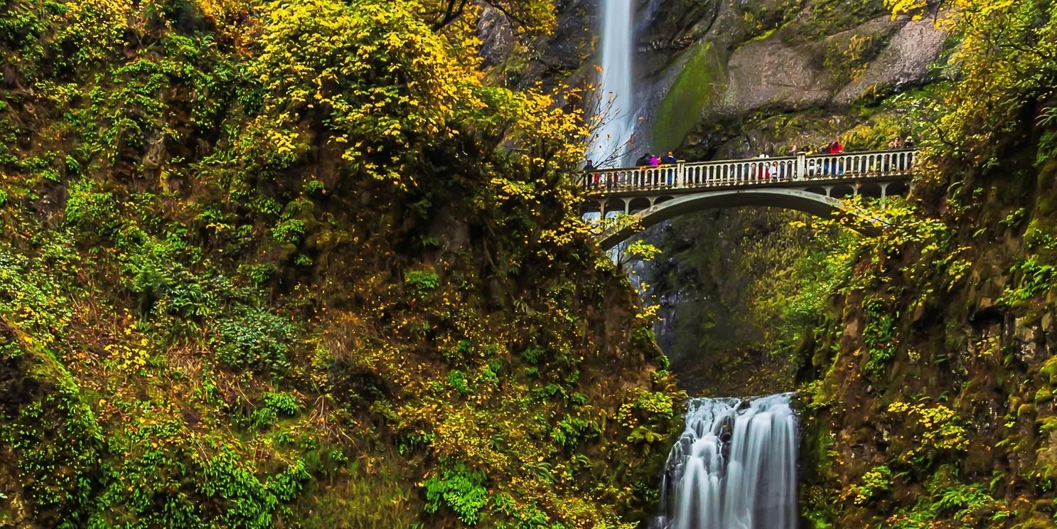
At 620 feet, Multnomah Falls is Oregon’s tallest waterfall and the Columbia Gorge’s most iconic landmark. Immense crowds are part of the scene here, as people enjoy the view, the spray, and the trails, along with the coffee, visitor center, and gift shop. More languages are heard at Multnomah Falls than perhaps any other place in Oregon. For quieter contemplation of this natural wonder, visit early or late in the day, or in winter, when ice can shroud the falls. The out-and-back hike to the overlook atop the upper falls is 2.4 miles total, with 800 feet of elevation gain.
Permits & Pets
Timed use permits are required at the I-84, Exit 31 parking lot from 9 a.m.-6 p.m. May 26-Sept. 4. Timed entry offers a one-hour time slot for arrival, but visitors may stay as long as desired.
Obtain timed use permit: via Rec.gov (can reserve up to two weeks prior) or U.S. Forest Service.
The U.S. Forest Service administers this site. No permits are required. Dogs must be on leash.
Trail Notes
- From Multnomah Falls Lodge, walk to the overlook below the lower tier of Multnomah Falls, which drops 69 feet. Then follow the paved trail (Larch Mountain Trail/Trail 441) up to the Benson Bridge, which sits between the two tiers.
- Beyond the bridge, the trail switchbacks steeply uphill, with excellent Columbia River views. In 1.1 miles, turn right to the viewpoint atop the upper falls, via Multnomah Falls Overlook Spur Trail/Trail 441A.
- Walk 0.1 mile to a wooden overlook that’s thrillingly close to where the upper falls begins its 542-foot drop. (The total drop is 620 feet: 69 in the lower falls, 9 feet between the falls, and 542 feet for the upper falls.)
- Retrace your steps to the start.
- Please always stay on the trail and clean your boots before and after you hike. Hikers are a common vector for spreading invasive seeds.
- Restrooms are available in Multnomah Falls Lodge’s lower level.
Friends of the Columbia Gorge does not track trail closures. If you are planning a hike in the Gorge, please check other sources in advance for the latest updates, including the U.S Forest Service, Ready Set GOrge, and AllTrails. Recreational activities in the Gorge can involve risk of injury, death, property damage, and other dangers. Friends does not assume responsibility for any such outcome resulting from the use of the information on our hiking web pages. Your use of these web pages is strictly at your own risk.
Post-Hike Explorations
Spend some time learning about this iconic place in the lower level of the lodge, at the Visitor Center. It’s jointly staffed by the all-volunteer Friends of Multnomah Falls and the U.S. Forest Service. In the adjacent gift shop are books and maps, along with souvenirs.
Other Hikes from This Trailhead
- Multnomah Falls to Wahkeena Falls Loop
- Multnomah Falls to Franklin Ridge Loop
- Multnomah Falls to Devil’s Rest
- Multnomah Falls to Larch Mountain
Directions & Travel Tips
East- or westbound I-84, get in the left lane to take exit 31/Multnomah Falls. Park in the large lot between I-84’s east- and westbound lanes, and walk under the freeway and on the paved walkway along Multnomah Creek to Multnomah Falls Lodge. Restrooms are in its lower level.
To approach Multnomah Falls from the Historic Columbia River Highway (not recommended during busy seasons, as traffic can slow to a crawl), if westbound on I-84, take exit 35/Ainsworth and drive 4 miles west on the Historic Highway to the lodge. Parking is very limited along the Historic Highway. Eastbound on I-84, take exit 28/Bridal Veil and drive 3 miles east on the Historic Highway to Multnomah Falls. (View current parking lot capacity.)
Car-Free Travel
The Columbia Gorge Express shuttle stops at this location. Click here for schedule and fare information.