On the Trail
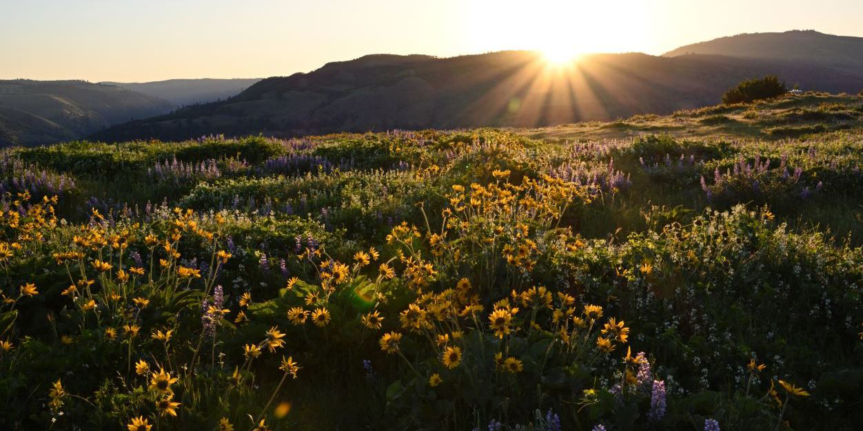
This easy, 2-mile hike loops across a clifftop plateau with outstanding views of sculptural Eastern Gorge cliffs and plateaus. In April and May, balsamroot and other wildflowers are abundant. The hike drops 240 feet over 1 mile, which you regain on the return. Pair this short walk with the nearby hike to McCall Point. Both are within the 231-acre Tom McCall Preserve at Rowena , land protected by the Nature Conservancy.
Permits & Pets
The property is owned by the Nature Conservancy. No permits are required. Dogs are not allowed, on or off leash.
Trail Notes
- The trail begins at the entrance to the overlook, at the junction with the Historic Highway. From here, begin walking west toward the edge of a cliff high above Rowena Dell.
- The trail follows the rim, then encounters the first of two kolk ponds, depressions in the basalt created by the churning action of the Ice Age floods that once overtopped this 700-foot-high cliff. The depressions harbor moisture, and are the most vegetated places atop this arid bluff. Poison oak is one of the plants that thrive here.
- Stay on the trail as it extends to a point, with excellent views west down the Columbia Gorge. Retrace your steps; at the kolk pond, veer left to walk along the edge of cliffs facing northeast, with fantastic views of the Columbia and the Lyle Sandbar at the mouth of the Klickitat River. Walk by another kolk pond, then keep left to return to the start.
Friends of the Columbia Gorge does not track trail closures. If you are planning a hike in the Gorge, please check other sources in advance for the latest updates, including the U.S Forest Service, Ready Set GOrge, and AllTrails. Recreational activities in the Gorge can involve risk of injury, death, property damage, and other dangers. Friends does not assume responsibility for any such outcome resulting from the use of the information on our hiking web pages. Your use of these web pages is strictly at your own risk.
Post-Hike Explorations
After this short hike, don’t miss the Tom McCall Point hike, accessed from the same parking area. Then, explore a bit further east on the Historic Columbia River Highway, descending off the plateau on the beautiful Rowena Loops, constructed in 1919. Like the loops that lift travelers up to Crown Point at the gorge’s west end, this graceful stretch of roadway lays upon the land like a ribbon carefully arranged to complement the cliffs.
East of the last loop is Rowena Ferry Road, named for the ferry that once crossed the Columbia between Rowena and Lyle. Explore a decaying remnant of this road and other sites at Mayer State Park: Once down from the Rowena Loops, turn left in Rowena at the freeway exit. Instead of going right to head east on I-84, go left to pass under it and onto Rowena River Road. Follow it 0.8 mile east to a day use area for windsurfers. After exploring here or watching the action, go west on the same road; once past the freeway intersection, the road is the Rowena Ferry Road. Continue west. Pass a boat ramp, park along the road and walk to a rare, warm-water (relatively speaking) pond with sandy beaches.
Like the features on Rowena Plateau, it’s a kolk pond. A trail west of the lake leads to sand dunes and a small beach on the Columbia.
On the old ferry road, explore to east-facing areas, though the beaches aren’t as nice. Then head back to the Historic Columbia River Highway and follow it east 10 scenic miles to The Dalles for lunch or dinner in its historic downtown, or a stop at the Columbia Gorge Discovery Center and Museum.
Other Hikes at or Near This Trailhead
Directions & Travel Tips
On I-84, take exit 69/Mosier, and exit onto the Historic Columbia River Highway. With no restrooms at the trailhead, a stop at Mosier Totem Plaza makes a good restroom break. From the plaza, continue east on the highway 6.3 miles and turn right into the Rowena Crest overlook.