On the Trail
This 6.2-mile out-and-back hike travels beyond popular Punch Bowl Falls, farther into the deep green canyon of Eagle Creek to a spectacular 120-foot-high bridge. Elevation gain is 970 feet. Though easy, this hike is not suitable for young children because of the narrow passage, in places, along very high cliffs.
Since it was blasted out of sheer cliffs a century ago, the Eagle Creek Trail (Trail 440), with its waterfalls, high cliffs, and old-growth forest, is one of the most popular hikes in the Columbia River Gorge.
Permits & Pets
The site is managed by the U.S. Forest Service. A Northwest Forest Pass is required to park. Pay $5 cash at the trailhead kiosk, or, purchase one in advance. Dogs are required to be on a leash no longer than 6 feet at all times. However, we do not recommend taking dogs on this hike.
Trail Notes
- Begin at the trailhead at road’s end. Within 0.5 mile, the trail climbs high above the creek. In places, it is narrow with a very steep drop-off. Hold onto the cables that run along the trail where it hugs the cliffs.
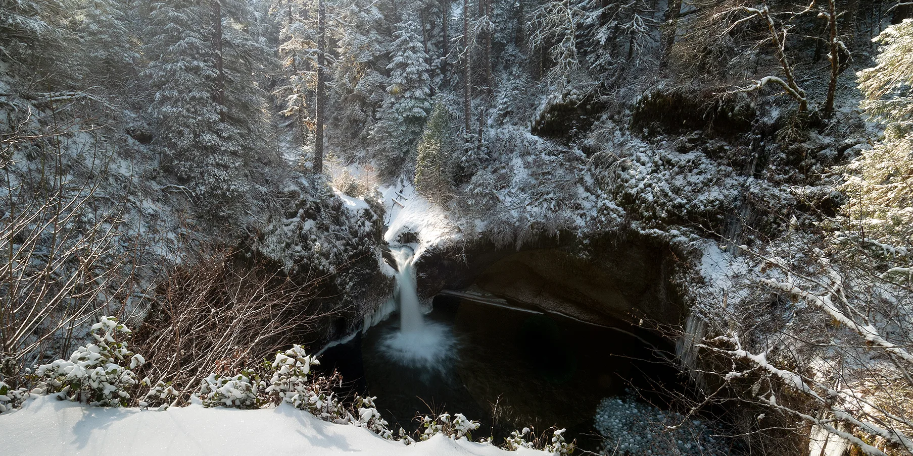
- In 1.9 miles, come to a signed junction for Punch Bowl Falls. Either take the trail downhill about 300 feet to Lower Punch Bowl Falls, a 12-foot-high falls that’s popular with swimmers (jumping, by the way, is illegal), or scramble along the shoreline (or swim the creek) upstream to Punch Bowl Falls, with its 33-foot drop and elegant pool, the subject of countless photographs.
- If you stay on the main trail, in about 0.25 mile come to the Punch Bowl Falls Overlook. It offers a view of the falls from above.
- Continuing onward, the trail swings away from Eagle Creek’s gorge, then emerges back into it high above the creek bed. Watch for horsetail-shaped Loowit Falls on the opposite bank. It drops 88 feet from a tributary stream into a pool before spilling into Eagle Creek.
- From here, the trail leads next to High Bridge. Although wide and well groomed, the trail is rocky and can be slippery, and is at the edge of a 120-foot-high cliff. A cable affixed to the rock wall provides some security. Pass others with care, and keep any dogs on a very short leash.
- High Bridge is aptly named: It spans a narrow channel 120 feet above the creek. For lunch at this turnaround spot, sit at one of the often-crowded viewpoints near the bridge or walk another hundred yards to Tenas Camp and find a quiet spot to sit.
- Retrace the route back to the trailhead.
- Please always stay on the trail and clean your boots before and after you hike. Hikers are a common vector for spreading invasive seeds.
- On the road to the trailhead, restrooms are to the left, adjacent to a parking area.
Friends of the Columbia Gorge does not track trail closures. If you are planning a hike in the Gorge, please check other sources in advance for the latest updates, including the U.S Forest Service, Ready Set GOrge, and AllTrails. Recreational activities in the Gorge can involve risk of injury, death, property damage, and other dangers. Friends does not assume responsibility for any such outcome resulting from the use of the information on our hiking web pages. Your use of these web pages is strictly at your own risk.
Post-Hike Explorations
If you have energy for one more Eagle Creek excursion, visit the Eagle Creek Overlook, now a group campground site. It was built by the Civilian Conservation Corps crews in the 1930s high on a bluff, with a view of the Columbia and Bonneville Dam. Oddly remote and little visited, its solitude is a nice counterpoint to the busy Eagle Creek Trail. Don’t miss the picnic shelter and its riverfront trail that ends at a small overlook, in sight of Native American fishing scaffolds. Views include Table Mountain, Red Bluffs, and Greenleaf Peak. From their heights, the Bonneville Landslide cut loose; the debris flow blocked the Columbia for a time. When the river eventually chewed through the mass of rocks, trees, and soil, it left behind a whitewater path, the Great Cascades of the Columbia.
Get to the overlook by driving downstream along Eagle Creek. Go under I-84 to the gate in the road. If it’s locked, that means you can park and hike up to the overlook. If the gate is open, don’t go in, because the site is being used by a group that has reserved it for private use.
Other Eagle Creek Trail Hikes from This Trailhead
- To Punch Bowl Falls: 3.8 miles, out-and-back, 600 feet of gain
- To Tunnel Falls: 12 miles, out-and-back, 1,640 feet of gain
- To Wahtum Lake: 25.5 miles, out-and-back, 5,210 feet of gain
Directions & Travel Tips
Eastbound I-84: Take exit 41/Eagle Creek. At the end of the ramp, turn right, and drive 0.6 mile along Eagle Creek to the parking area and trailhead at road’s end. Park only in designated spaces. If the parking area is full, turn around and park in the large lot near the restroom and fish hatchery. This will add about 1 mile (round trip) to the hike.
Westbound I-84: There is no exit, so take exit 40/Bonneville Dam; turn left to cross over I-84 and then left onto the eastbound ramp to I-84. In 1 mile, take exit 41/Eagle Creek, and follow directions above.