On the Trail
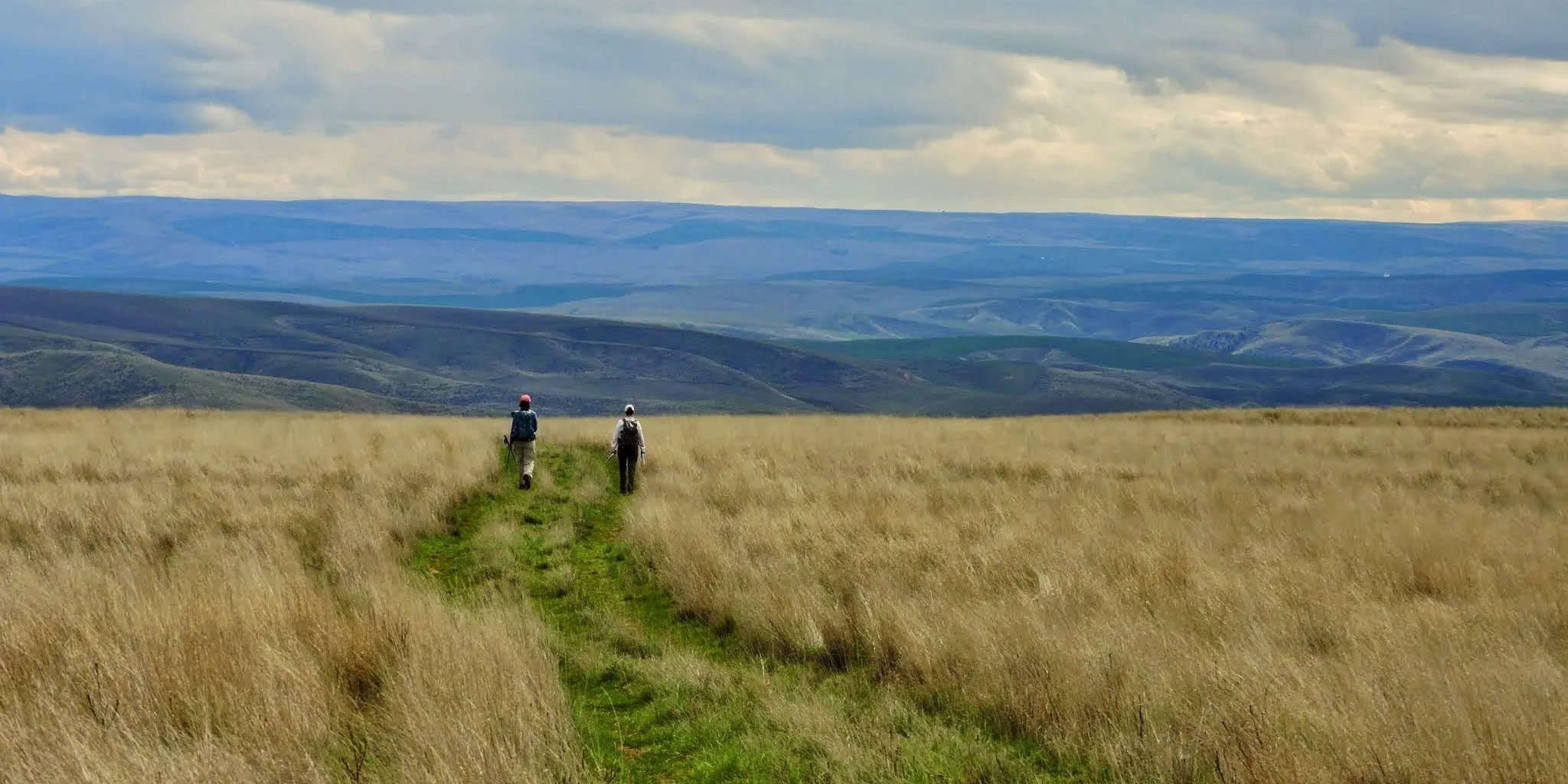
This easy-to-moderate, figure-eight loop ranges from 5 to 8.5 miles, with up to 1,300 feet of elevation gain. On rolling hills once grazed by cattle at Dalles Mountain Ranch, wildflowers are now abundant in spring, and the song of western meadowlarks nesting in the grasses and flowers accompanies hikers. Views of the eastern Gorge are epic in every season. With very little shade, this is a hike for fall through spring.
Permits & Pets
This property is managed by Washington State Parks. A Discover Pass is required to park. Purchase one in advance. Dogs are required to be leashed at all times.
Trail Notes
- At the trailhead kiosk, take a photo of the trail map. All trail junctions are marked with brown metal posts that signify the trail directions. This description proceeds counterclockwise through the lower loop of the figure-eight and clockwise through the upper loop.
- Ascend the Entry Road Trail along Eightmile Creek and learn about the Missoula Floods at the overlook. Just past it, take a few steps to the right for a view of Eightmile Creek Falls. Continue up the road and through an unlocked gate. At the 1-mile point on Entry Road Trail, turn right and follow the brown metal signs toward the Military Road Trail and the Vista Loop Trail.
- After crossing the creek, come to a junction. On the left is a long meadow that was once a homestead. A relic orchard is at the far end. Turn right here and follow the Vista Loop Trail uphill. It traverses the hillside eastward and then turns north to gently climb to increasingly spectacular views of the Columbia, both east and west.
- Turn left onto the Military Road Trail. Here, the upper and lower loops share the trail for 0.5 mile. Come to the junction with Eightmile Alternate Trail. To hike only the lower loop—a 5-mile hike—turn left here to walk the upper reaches of the homestead, then turn right at the junction near Eightmile Creek, and retrace your steps down Entry Road Trail to the start.
- To hike the upper loop, turn right on Eightmile Alternate Trail and follow it past two creek drainages. After the second drainage, turn left to explore the pond and buildings at the old Crawford Ranch. The upper trail parking area and restroom are east of the ranch buildings. After you’ve looked around, come back to the junction of the Eightmile Alternate Trail and Vista Loop Trail. Turn left on Vista Loop Trail. Head southeast on it (ignoring a trail to the left that leads north to Dalles Mountain Road).
- Turn right onto the Military Road Trail, and then left onto Eightmile Alternate Trail. Descend through the upper reaches of the old homestead. Turn right at the junction just before crossing Eightmile Creek, onto Entry Road Trail. Follow it downhill to the start.
- Please always stay on the trail and clean your boots before and after you hike. Hikers and their dogs are common vectors for spreading invasive seeds.
- Restrooms are located at both trailheads.
History
This hike is at the former Dalles Mountain Ranch, a large ranch that ceased operations in the early 1990s.
Yakima Valley ranchers Pat and Darlene Bleakney ran the ranch for 18 years until they were preparing to retire. Recognizing its natural beauty and historical value, they approached the state of Washington in hopes of moving their beloved property into the public domain.
The upper ranchland (see the Stacker Butte hike) was sold to the Washington Department of Natural Resources in 1993. About 3,200 acres, including Stacker Butte, became the Columbia Hills Natural Area Preserve, set aside to protect rare plant communities. The balance of the ranch, about 3,100 acres, including most of the structures and ranch house seen on this hike, was deeded to Washington State Parks. With existing park areas along the riverfront — Horsethief Butte and Horsethief Lake — it was consolidated into one park, Columbia Hills Historical State Park.
Friends of the Columbia Gorge does not track trail closures. If you are planning a hike in the Gorge, please check other sources in advance for the latest updates, including the U.S Forest Service, Ready Set GOrge, and AllTrails. Recreational activities in the Gorge can involve risk of injury, death, property damage, and other dangers. Friends does not assume responsibility for any such outcome resulting from the use of the information on our hiking web pages. Your use of these web pages is strictly at your own risk.
Post-Hike Explorations
After this hike at the old Dalles Mountain Ranch, cross the river to have a meal and spend the night in historical The Dalles, Oregon. Lift a pint in a former U.S. Mint building, or in an 1876 saloon, or enjoy other restaurants on and near Second Street, downtown’s main street. Afterward, take a short stroll along The Dalles Riverfront Trail, or in summer wade or swim at the Riverfront Park beach or at The Dalles Public Pool and Splash Park, renovated in 2016.
Other Hikes at or Near This Trailhead
Directions & Travel Tips
From the intersection of U.S. 197 and SR 14, drive 3.6 miles east on SR 14 to the Crawford Oaks Trailhead and parking area, on the left (north) side of the road. This trailhead leads to the hike’s lower loop. To start at the upper loop, from U.S. 197 and SR 14, drive 0.9 mile east on SR 14 and turn left on gravel Dalles Mountain Road. In 3.4 miles, keep right and drive another 0.2 mile to the parking area and restroom beyond the ranch buildings.