On the Trail
This 4-mile, out-and-back hike gains 1,150 feet of elevation. The tameness of the gravel road belies the wonders in this natural area, once part of the large Dalles Mountain Ranch. With no shade, this is a hike best for fall through spring.
In April and May, the hike features one of the Northwest’s best wildflower displays of balsamroot, lupine, paintbrush, phlox, and larkspur. The area is part of the 3,600-acre Columbia Hills Natural Area Preserve, set aside to preserve habit for rare wildflowers. It’s also home to high-quality, undisturbed grassland and scabland plant communities.
Permits & Pets
This property is managed by Washington State Parks. A Discover Pass is required to park. Purchase one in advance. Dogs are not permitted in this area.
Trail Notes
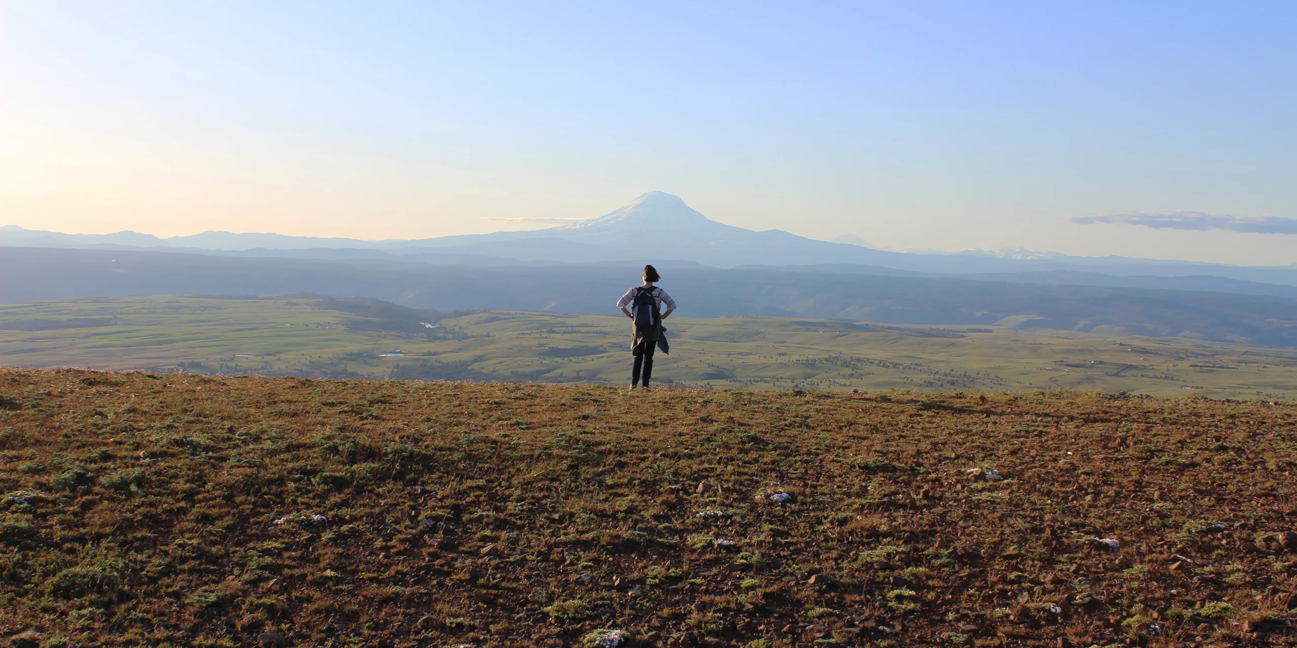
- From the gate, walk uphill on the gravel road. Because this is a protected area, do not walk off the road. At 1.1 miles, a jeep track on the right under power lines leads in about 0.7 mile to Oak Spring, a perennially green oasis of Oregon white oak that was a water source for Native Americans and homesteaders. Continue up the main road to the summit of Stacker Butte, 3,220 feet. Henry Stacker came to Klickitat County in 1883. From his homestead on High Prairie, he grazed sheep atop the butte.
- Atop the butte today are microwave towers and a wigwam-shaped antenna that provides a signal to aircraft arriving and departing from Portland International Airport.
- The windy peak offers up stunning views of Mount Adams and Mount Hood. To the north are views of Swale Canyon and the Klickitat River Valley.
- Please always stay on the trail and clean your boots before and after you hike. Hikers are a common vector for spreading invasive seeds.
- Restrooms are at the upper Crawford Oaks trailhead, just east of the fork in the road.
History
This hike is at the former Dalles Mountain Ranch, a large ranch that ceased operations in the early 1990s. Yakima Valley ranchers Pat and Darlene Bleakney ran the ranch for 18 years until they were preparing to retire. Recognizing its natural beauty and historical value, they approached the state of Washington in hopes of moving their beloved property into the public domain.
The upper ranchland was sold to Washington’s Department of Natural Resources in 1993. About 3,200 acres, including Stacker Butte, became the Columbia Hills Natural Area Preserve, set aside to protect rare plant communities. The balance of the ranch, about 3,100 acres, including most of the structures and ranch house seen on this hike, was deeded to Washington State Parks. With existing park areas along the riverfront—Horsethief Butte and Horsethief Lake—it was consolidated into one park, Columbia Hills Historical State Park.
Friends of the Columbia Gorge does not track trail closures. If you are planning a hike in the Gorge, please check other sources in advance for the latest updates, including the U.S Forest Service, Ready Set GOrge, and AllTrails. Recreational activities in the Gorge can involve risk of injury, death, property damage, and other dangers. Friends does not assume responsibility for any such outcome resulting from the use of the information on our hiking web pages. Your use of these web pages is strictly at your own risk.
Post-Hike Explorations
Another 14 scenic miles east on SR 14 is Maryhill Museum of Art, an oasis of green, culture, and good food in a fantastically located clifftop-home-turned-museum. Along the way on SR 14 are two wineries to explore.
Other Hikes at or Near This Trailhead
- Columbia Hills Historical State Park: Crawford Oaks
- Columbia Hills Historical State Park: Horsethief Butte
- Columbia Hills Historical State Park: Petroglyph Tour
Directions & Travel Tips
From U.S. 197 and SR 14, drive 0.9 mile east on SR 14 and turn left on gravel Dalles Mountain Road. In 3.4 miles, keep left at the fork in the road. Drive another 1.4 miles to a gate. Park here, but do not block the gate.