On the Trail
This 1.5-mile loop is flat and pleasant, and accessible to all users. Discovering what “whistle punk” means will not be the only thing you’ll learn at this interesting outdoor museum about the region’s timber history. Pass by old logging equipment, wetlands, and a bit of old-growth forest.
Permits & Pets
This site is within the Gifford Pinchot National Forest. A Northwest Forest Pass is required and can be purchased here. Dogs must be on leash.
Trail Notes
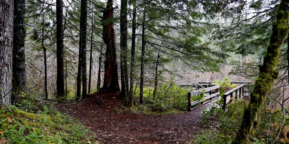
- Go right at the first trail junction to make a counterclockwise loop. Pass through a deciduous forest with moss-draped Oregon ash, then enter a maturing Douglas fir forest with logging camp displays. At the far point of the loop, come to a wooden observation deck at a wetland.
- Directly across from the deck, look for a tower. It used to support the Wind River Canopy Crane, which rose 25 stories above the ground in the adjacent Thornton T. Munger Research Natural Area, 1,180 acres of old-growth timber and other habitats. From 1994 to 2011, researchers could use a gondola attached to the crane’s jib to move around the tree canopy, gathering samples and doing experiments.
- With the data gathered, researchers published more than 250 articles on topics ranging from carbon flow to the retention of pollutants in lichens. Changing priorities led to the crane’s removal, but its tower still transmits data to researchers.
- Continuing on the loop, emerge onto a gravel road. Turn right to visit the tower in about 0.3 mile. Or go left to stay on the loop.
- The road soon ends at a gate. Enter a meadow, the former site of a federal tree farm, where seedlings were raised for replanting in logged and burned areas. High fences kept deer and elk from grazing on young seedlings. The fences are now breached, and browsing elk are a welcome sight.
- The trail returns to the forest and a boardwalk leads through the ash swamp before returning to the trailhead.
- Please always stay on the trail and clean your boots before and after you hike. Hikers are a common vector for spreading invasive seeds.
- Restrooms are at the trailhead.
Friends of the Columbia Gorge does not track trail closures. If you are planning a hike in the Gorge, please check other sources in advance for the latest updates, including the U.S Forest Service, Ready Set GOrge, and AllTrails. Recreational activities in the Gorge can involve risk of injury, death, property damage, and other dangers. Friends does not assume responsibility for any such outcome resulting from the use of the information on our hiking web pages. Your use of these web pages is strictly at your own risk.
Post-Hike Explorations
On the north end of Carson, one block east of Wind River Highway at Metzger Road is the immense log yard at the High Cascade mill. This sawmill and planer mill produces kiln-dried and green (not dried) dimensional lumber. About half the wood milled is Douglas fir, and most of the rest is white fir, with some ponderosa pine. The wood comes from Oregon and Washington forests, both publicly and privately owned. It is one of the few large mills remaining in the region.
Other Hikes at or Near This Trailhead
Directions & Travel Tips
From SR 14 at the Bridge of the Gods (tolls are required on the bridge), drive 5.9 miles east on SR 14 to Wind River Road. Drive uphill to Carson.
At the four-way stop at Hot Springs Avenue, continue straight 8.5 miles, then turn left on Hemlock Road in the community of Stabler. In 1.2 miles, just past the historic Wind River Work Station (but before crossing Trout Creek), turn right onto FS Road 43. Drive 0.5 mile and take the next right onto FS Road 417. Follow it 0.5 mile to its dead end at a parking area and the trailhead. Restrooms are at the trailhead.