On the Trail
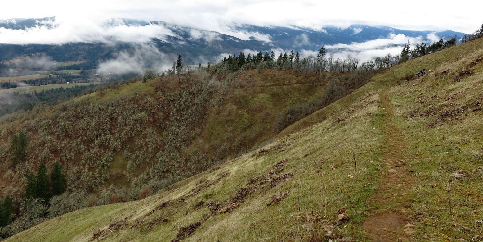
This out-and-back hike runs 2.3 miles along a 1911 wagon road, passing through a woodland of Oregon white oak, Washington’s only native oak species. In spring, balsamroot and lupine color the slopes; year-round, the oaks harbor an abundance of wildlife—156 species have been noted here. Views are far-reaching, of the White Salmon Valley and Mount Hood. The route gains 1,300 feet of elevation, for a total of 4.6 miles.
Permits & Pets
The trailhead and part of the hike are on private land, and other sections are on Washington Department of Natural Resources land. No permit is required. Dogs are not permitted at any time.
Trail Notes
- To find the trailhead, walk 0.1 mile up an abandoned road to a sign for the Weldon Wagon Trail. Early settlers used sleds to bring produce down and supplies up to their homesteads. This road, built by Elwin Weldon and Henry Hyndman, marked a significant transportation leap. No longer used, decades have narrowed the road in places to a single-track path.
- At 1.4 miles, the trail enters the White Salmon Oak Natural Resources Conservation Area, 315 acres established in 1993. At 2.3 miles, the trail reaches Sanborn Road, the turnaround point. Retrace your steps back to the start.
- Please always stay on the trail and clean your boots before and after you hike. Hikers and their dogs are common vectors for spreading invasive seeds.
- There is no restroom at the trailhead.
Friends of the Columbia Gorge does not track trail closures. If you are planning a hike in the Gorge, please check other sources in advance for the latest updates, including the U.S Forest Service, Ready Set GOrge, and AllTrails. Recreational activities in the Gorge can involve risk of injury, death, property damage, and other dangers. Friends does not assume responsibility for any such outcome resulting from the use of the information on our hiking web pages. Your use of these web pages is strictly at your own risk.
Post-Hike Explorations
Drive back down Highway 141, which turns into Jewett Boulevard, White Salmon’s main street. There, find a brewpub and other restaurants in a scenic downtown perched on a Columbia River bluff. Walking maps of this small town offer a different kind of exploration.
Directions & Travel Tips
From the Hood River Bridge (tolls are required on the bridge) and SR 14, turn left (west) onto SR 14. In 1.6 miles, turn right onto Highway 141 Alt. In 2.2 miles, turn left onto Highway 141. Drive 4 miles to Husum. Just before the bridge over Rattlesnake Creek, turn right onto gravel Indian Creek Road. Drive 0.6 mile and bear left onto Indian Cemetery Road. Continue 0.3 mile to a parking pullout at the road’s crest. There is no restroom at the trailhead.