On the Trail
This challenging 9-mile loop climbs the long Starvation Ridge to Warren Lake, the headwaters of Warren Creek. From there, it descends back to the Gorge floor via the Mount Defiance Trail. Views and solitude are superb; the route gains and loses 4,200 feet of elevation.
Permits & Pets
The Historic Columbia River Highway State Trail and Starvation Creek State Park are managed by Oregon State Parks. Dogs must be on a leash no more than 6 feet long. South of the state trail, the area is managed by the U.S. Forest Service. Dogs may be off leash. No passes are required. Part of the trail is within the Mark O. Hatfield Wilderness. Wilderness restrictions apply.
Trail Notes
- From the parking area, walk west on the Historic Columbia River Highway State Trail. In 0.2 mile, turn left onto the Starvation Cutoff Trail (Trail 414B). If you come to Cabin Creek Falls on the State Trail, you’ve gone too far.
- Trail 414B climbs extremely steeply for 0.4 mile. At the top, turn left onto the Starvation Ridge Trail (Trail 414). Follow it 1.6 miles to the junction with the Warren Lake Trail (Trail 417A) and turn right.
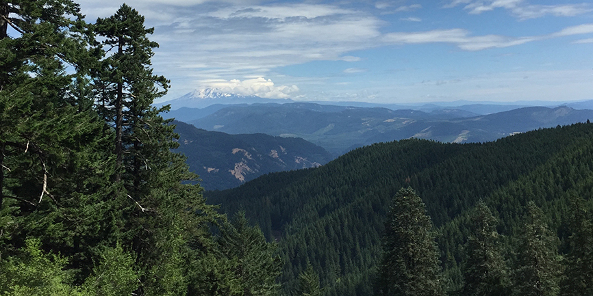
- In 1 mile, turn right onto Mitchell Point Trail (Trail 417); total mileage at this point is 3.2 miles with 3,793 feet of gain.
- In 0.4 mile, cross Warren Creek, where it begins at the north shore of Warren Lake, a 5-acre lake on the northeast flank of Mount Defiance.
- After exploring the lake or camping at one of its primitive campsites, continue west on the Mitchell Point Trail 0.7 mile to the Mount Defiance Trail (Trail 413).
- Turn right and walk the trail 4 downhill miles to the junction with the Starvation Ridge Trail; at this junction, keep downhill, cross over Warren Creek below Hole-in-the-Wall Falls, and keep right onto the paved Historic Columbia River Highway State Trail to return to the start.
- Please always stay on the trail and clean your boots before and after you hike. Hikers are a common vector for spreading invasive seeds.
- Restrooms are at the east end of the parking area.
Friends of the Columbia Gorge does not track trail closures. If you are planning a hike in the Gorge, please check other sources in advance for the latest updates, including the U.S Forest Service, Ready Set GOrge, and AllTrails. Recreational activities in the Gorge can involve risk of injury, death, property damage, and other dangers. Friends does not assume responsibility for any such outcome resulting from the use of the information on our hiking web pages. Your use of these web pages is strictly at your own risk.
Post-Hike Explorations
Visit Viento State Park’s beach to watch kiteboarders, wade, or take a swim. From Starvation Creek, drive I-84 for 1 mile, and take exit 56/Viento. Cross over I-84 to the park’s north side, and drive past its campground to the river access parking lot. An Oregon State Parks Pass is required. Views are spectacular: Across the river is 2,948-foot Dog Mountain and to its east 3,014-foot Cook Hill. From here, Hood River’s brewpubs are just another 7 miles farther east, off I-84, at exit 63.
Other Hikes from This Trailhead
Directions & Travel Tips
Starvation Creek Trailhead: From eastbound I-84: Take exit 55/Starvation Creek State Park and drive to the parking area. Westbound I-84: take exit 51/Wyeth and return to eastbound I-84, and take exit 55 as described above. Restrooms are at the east end of the parking area.