On the Trail
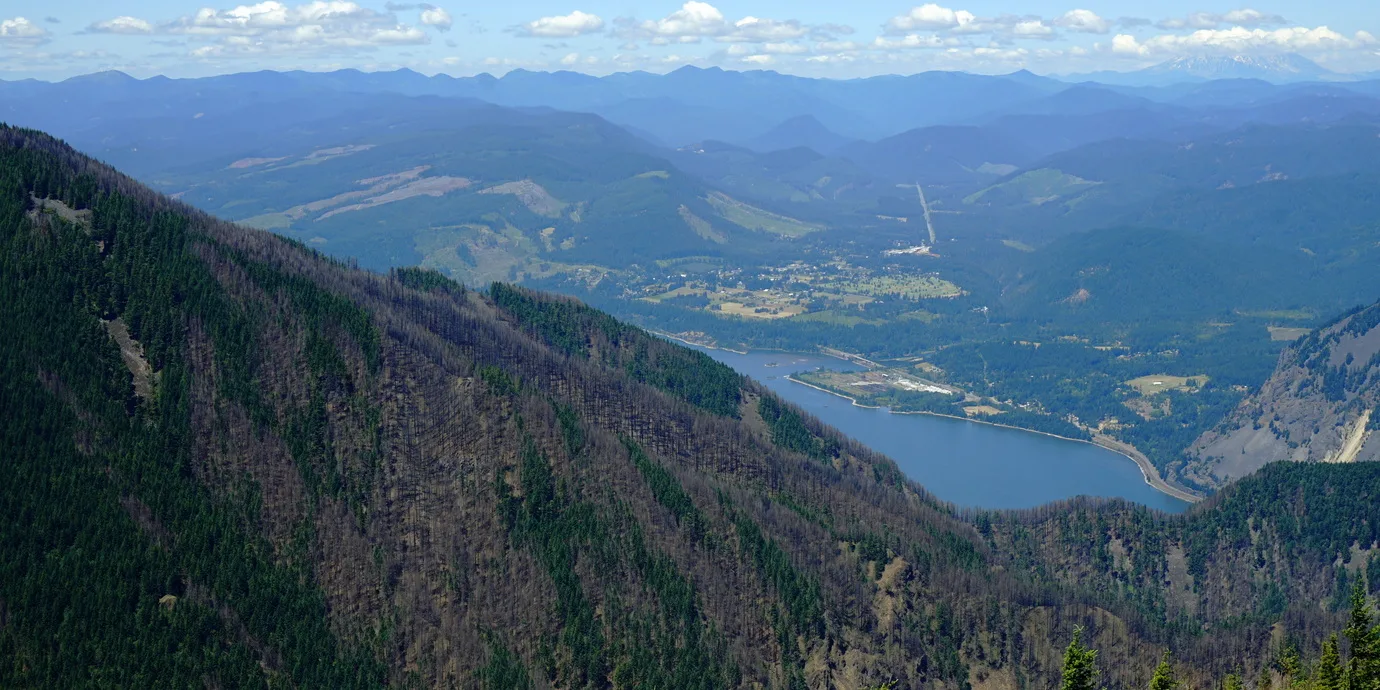
This extremely challenging hike climbs 4,900 feet in 5 miles, and returns via the same route, for a 10-mile out-and-back hike. Mount Defiance, at 4,960 feet, got its name because it hangs on to its snow longer than any other Gorge peak. This hike is best done from May to October. Choose a clear day, bring your Gorge map, and you’ll see five Cascade volcanoes, plus other Gorge landmarks such as Chinidere, Indian, Tomlike, Larch, Dog, and Wind mountains.
Permits & Pets
The Historic Columbia River Highway State Trail and Starvation Creek State Park are managed by Oregon State Parks. Dogs must be on a leash no more than 6 feet long. South of the State Trail and parking area, the land is managed by the U.S. Forest Service. Dogs may be off leash here. No passes are required. Part of the trail is within the Mark O. Hatfield Wilderness. Wilderness restrictions apply.
Trail Notes
- From the parking area, walk west on the Historic Columbia River Highway State Trail. Pass Starvation Cutoff Trail (Trail 414B) and Cabin Creek Falls. Keep left as the Mount Defiance Trail (Trail 413) leaves the state trail and crosses Warren Creek at Hole-in-the-Wall Falls.
- From here, the trail climbs gently to a junction with Starvation Ridge Trail (Trail 414). Keep right here; at this point you’re 0.8 mile from the trailhead.
- Past Lancaster Falls, Trail 413 steepens and begins to switchback, gaining 3,000 feet in elevation over the next 3 miles.
- Around the 3,500-foot level, the timber clears to reveal spectacular views at every turn, and the scree landscapes feel more alpine than the elevation would seem to merit.
- At 4 miles, come to a junction with Mitchell Point Trail (Trail 417 or sometimes referred to as Warren Lake Trail) on the left. Keep straight on Trail 413.
- From here, it’s 700 feet more to the summit. About halfway up this last pitch, come to a junction with the Defiance Cutoff Trail; it curves around the west side of Mount Defiance, providing views of Bear Lake, but it does not go as directly to the top.
- Staying on the main trail, you’ll soon reach the summit. Despite the rigorous climb, the setting is not remote from civilization: Radio towers occupy this former fire lookout.
- After enjoying the views, a rest, and lunch, return via the same route, or loop down: From the summit, turn right on the Mitchell Point Trail to Warren Lake, and down Starvation Ridge back to the Historic Columbia River Highway State Trail.
- Please always stay on the trail and clean your boots before and after you hike. Hikers are a common vector for spreading invasive seeds.
- Restrooms are at the east end of the parking area.
Friends of the Columbia Gorge does not track trail closures. If you are planning a hike in the Gorge, please check other sources in advance for the latest updates, including the U.S Forest Service, Ready Set GOrge, and AllTrails. Recreational activities in the Gorge can involve risk of injury, death, property damage, and other dangers. Friends does not assume responsibility for any such outcome resulting from the use of the information on our hiking web pages. Your use of these web pages is strictly at your own risk.
Post-Hike Explorations
Hood River’s brewpubs and other dining options are 8 miles east, off I-84, at exit 63. Heading west, Cascade Locks and its brewpubs and restaurants are 11 miles away, at exit 44.
Other Hikes from This Trailhead
- Starvation Ridge Loop
- Starvation Creek to Warren Lake
- Historic Columbia River Highway Trail: Viento State Park to Lindsey Creek
Directions & Travel Tips
Starvation Creek Trailhead: Eastbound I-84, take exit 55/Starvation Creek State Park and drive to the parking area. Westbound I-84, take exit 51/Wyeth, return to eastbound I-84, and take exit 55 as described above. Restrooms are at the east end of the parking area.