On the Trail
This 8.5-mile, one-way trek on the Klickitat Trail is great for a riverside walk or mountain biking; return via the same route for 17 miles round trip, or hike it one way and return via a car shuttle. The route is basically flat, gaining only 220 feet on the 8.5 miles between Fisher Bridge and Pitt.
Permits & Pets
The trail is administered by the U.S. Forest Service. No passes or permits are required. Dogs must be on leash on this stretch of the Klickitat Trail (and the entire trail).
Trail Notes
- Wear boots with tough soles: The trail is on the ballast rock of an old rail line.
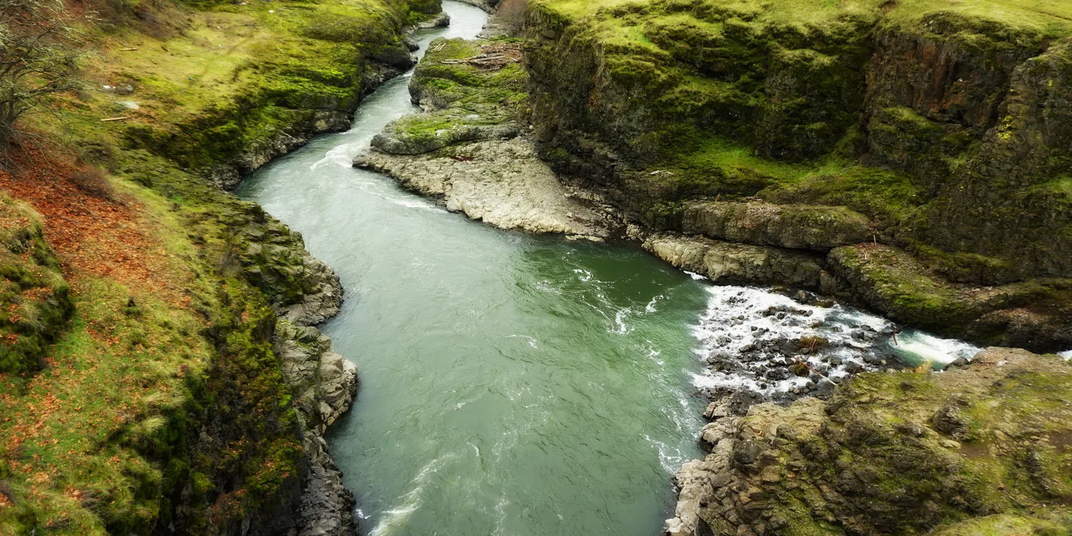
- From the parking area, begin walking right on the trail, immediately crossing a pedestrian bridge over the Klickitat River. This stretch of the river is one of several traditional Native American fishing sites along the Klickitat, where Native fishers still dip net for salmon from platforms suspended over the whitewater.
- In 0.5 mile, pass a fish-counting facility operated by the Yakama Nation Fisheries at the Lyle Falls Fishway. Some fish are collected for hatchery brood-stock purposes, but most are returned to the fishway to continue migrating after sampling. The counts don’t include fish that came up the natural waterfall at Lyle Falls.
- Continue upstream through sections of trees and open vistas to the Pitt trailhead, where there is a restroom.
- Be sure to stay on the trail, as private property and houses are adjacent in several sections and need to be respected.
- Please also clean your boots before and after you hike. Hikers are a common vector for spreading invasive seeds.
- There are no restrooms at the trailhead. The nearest restroom is at the Lyle trailhead to the Klickitat Trail, 1.6 miles south of this trailhead.
- Learn about the Klickitat Trail history at the Klickitat Trail Conservancy.
Friends of the Columbia Gorge does not track trail closures. If you are planning a hike in the Gorge, please check other sources in advance for the latest updates, including the U.S Forest Service, Ready Set GOrge, and AllTrails. Recreational activities in the Gorge can involve risk of injury, death, property damage, and other dangers. Friends does not assume responsibility for any such outcome resulting from the use of the information on our hiking web pages. Your use of these web pages is strictly at your own risk.
Post-Hike Explorations
Combine this hike with a visit to the other side of the river from the Lyle trailhead at the Balfour-Klickitat Day Use Area and Trail. Afterward, play a game of pool in Lyle, or eat in an old railroad hotel or at a classic corner grill.
Other Hikes at or Near This Trailhead
- Balfour-Klickitat Loop
- Klickitat Trail — Lyle to Fisher Hill
- Klickitat Trail — Fisher Hill to Klickitat
- Klickitat Trail — Swale Canyon
Directions & Travel Tips
From SR 14 and the Hood River Bridge (tolls are required on the bridge), drive east on SR 14 for 10.8 miles, then turn left onto Highway 142, just beyond the Klickitat River.
Drive 1.6 miles and veer left into a parking area for the Klickitat Trail on the left (west) side of Highway 142 by the Scenic Area-Fisher Hill sign. The trail begins adjacent to this parking area.
There are no restrooms at the trailhead. The nearest restroom is at the Lyle trailhead to the Klickitat Trail, 1.6 miles south of this trailhead.
For a car shuttle, leave a car at the Pitt trailhead, 10 miles north of SR 14 on Highway 142.