On the Trail
This 5.1-mile section of the Klickitat Trail breaks away from the Klickitat River and Highway 142 and follows remote Swale Creek through a canyon it has incised into High Prairie. The grade is gentle, losing 413 feet in 5.1 miles westward, and regaining it on the return, for a 10.2-mile hike, with 826 feet of elevation gain. This premier section of the Klickitat Trail is ideal for spring days, when wildflowers brilliantly paint the landscape. Mountain bikers and hikers share this trail.
Permits & Pets
The trail is administered by Washington State Parks in this section. No passes or permits are required. Dogs must be on leash. Remain on the path because adjoining lands are private property.
Trail Notes
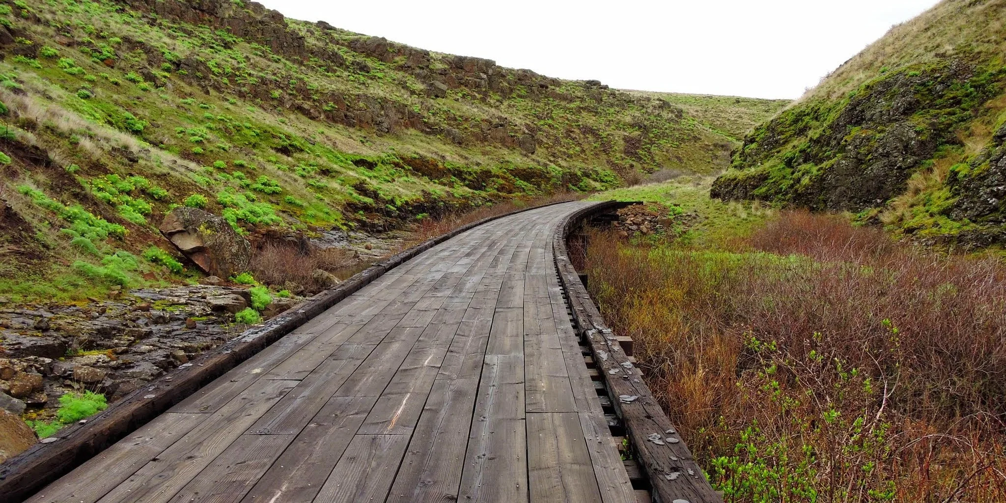
- Wear boots with tough soles: The trail is on the ballast rock of an old rail line.
- From the trailhead, turn left (west) on the Klickitat Trail. Near mile two, the route starts its descent into Swale Canyon, a remote gorge punctuated with volcanic rock outcroppings and vibrant Columbia desert parsley in spring.
- Cross three railroad trestles in the next 1.5 miles and continue west.
- After 4.5 miles, the route swings north for the final 0.6 mile to a waterfront lunch spot along Swale Creek—look for the creek’s chutes, waterfalls, and small pools, inviting you to stay awhile.
- Retrace your steps to the start.
- Please always stay on the trail and clean your boots before and after you hike. Hikers are a common vector for spreading invasive seeds.
- There is a restroom at the trailhead.
- Learn about the Klickitat Trail history at the Klickitat Trail Conservancy.
Friends of the Columbia Gorge does not track trail closures. If you are planning a hike in the Gorge, please check other sources in advance for the latest updates, including the U.S Forest Service, Ready Set GOrge, and AllTrails. Recreational activities in the Gorge can involve risk of injury, death, property damage, and other dangers. Friends does not assume responsibility for any such outcome resulting from the use of the information on our hiking web pages. Your use of these web pages is strictly at your own risk.
Post-Hike Explorations
Loop back to Lyle and SR 14 via scenic gravel roads that offer fantastic views of Fulton and Kaser ridges on the Oregon side of the Columbia, between The Dalles and the Deschutes River. The U.S. Forest Service map of the Gorge labels both roads as “gravel roads, suitable for passenger cars.”
From Harms Road and the Centerville Highway, drive east 2.2 miles on the Centerville Highway and turn right on gravel Uecker Road. In 1.3 miles, turn right on Dalles Mountain Road, also gravel. Follow it 6.5 miles to the trailhead for the Crawford Oaks hike; continue on Dalles Mountain Road 3.7 more miles to SR 14. Turn right and drive the 8 miles back into Lyle.
Play a game of pool in Lyle, or eat in an old railroad hotel or at a classic corner grill.
Directions & Travel Tips
Swale Canyon trailhead: From SR 14 and the Hood River Bridge (tolls are required on the bridge), drive east on SR 14 for 11 miles to the Centerville Highway/Sixth Street intersection in Lyle (at the Country Cafe). Turn left, following Centerville Highway 14.7 miles to Harms Road. Here, turn left. In 0.5 mile, come to the Swale Canyon trailhead to the Klickitat Trail. Park just north of the bridge over Swale Creek. There is a restroom at the trailhead.