On the Trail
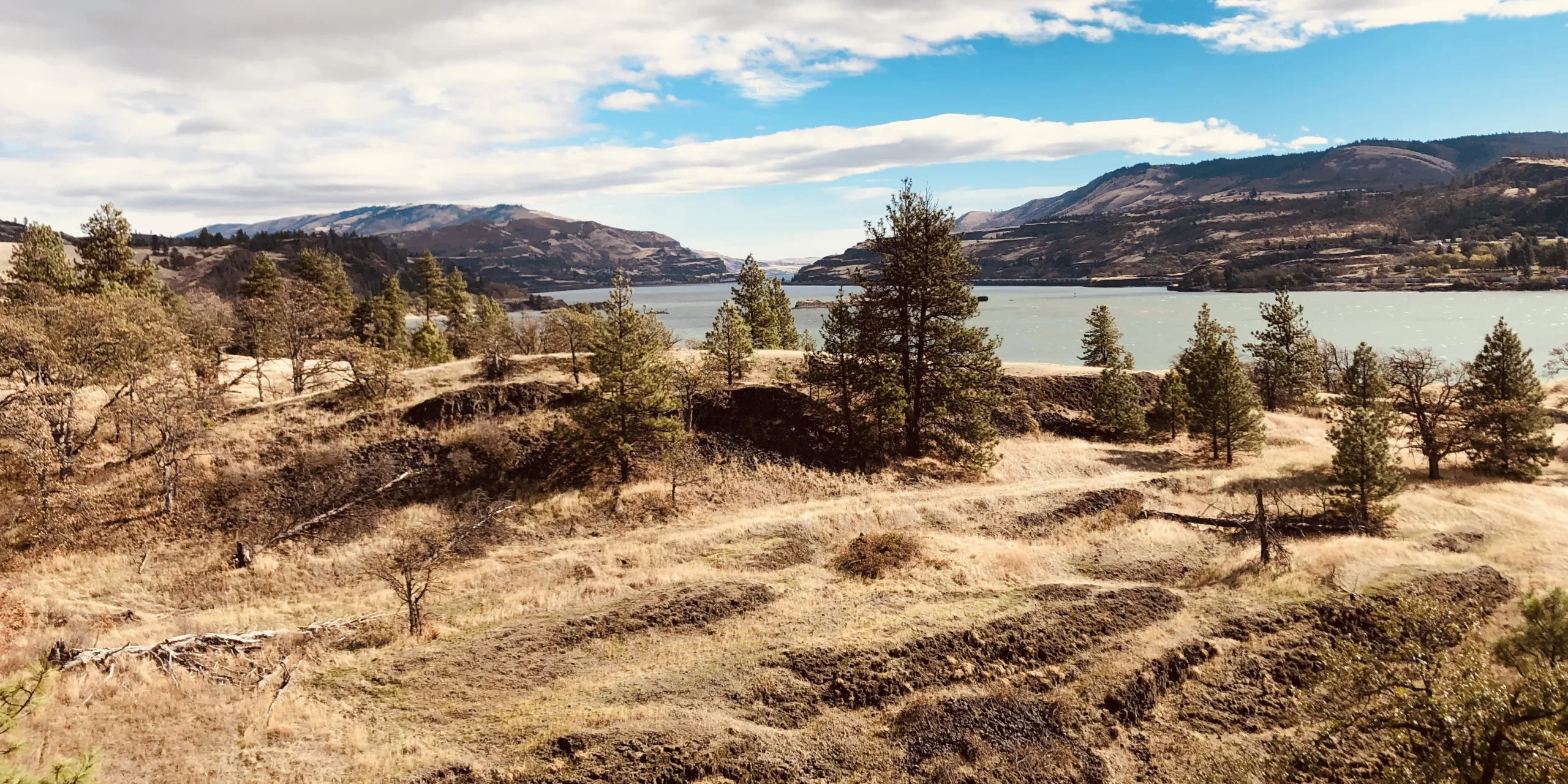
This 1.2-mile paved loop passes through some of the Gorge’s most spectacular scenery, including a famous explosion of spring wildflowers, far-ranging views, and sculptural rock outcrops. Where humans now click photos, cattle once roamed. Until the 1980s, this was ranchland.
Permits & Pets
Catherine Creek is administered by the U.S. Forest Service. No pass is required. Dogs are required to be leashed at all times.
Trail Notes
- The 4-foot-wide trail has a steep section with a 10 percent maximum grade that may be difficult for some users.
- From the trailhead on the south side of Old Highway 8, walk the paved trail to a junction, the start of the loop. Turn either way; these directions have you turning left.
- Learn about the area’s history and wildflowers via interpretive signs, then come to a viewpoint of Catherine Creek Falls. From here, the trail drops via switchbacks and crosses a bridge over a vernal pool — one that fills and dries out seasonally. Pass a shortcut trail, which heads uphill to the right. At the base of the hill, a few oaks provide the rare bit of shade on this walk. The trail gradually climbs, passing under a small bluff. Pass the upper junction of the shortcut trail and come to the end of the loop. Turn left to return to the trailhead.
- Please always stay on the trail and clean your boots before and after you hike. Hikers and their dogs are common vectors for spreading invasive seeds.
- A portable toilet is at the trailhead.
Friends of the Columbia Gorge does not track trail closures. If you are planning a hike in the Gorge, please check other sources in advance for the latest updates, including the U.S Forest Service, Ready Set GOrge, and AllTrails. Recreational activities in the Gorge can involve risk of injury, death, property damage, and other dangers. Friends does not assume responsibility for any such outcome resulting from the use of the information on our hiking web pages. Your use of these web pages is strictly at your own risk.
Post-Hike Explorations
See the Catherine Creek Arch Loop hike (link below) for dining suggestions in nearby Bingen. Or go to its sister city, White Salmon: Drive Old Hwy 8 and SR 14 west 6 miles to Bingen, then turn right on Oak Street/Jewett Boulevard. It leads uphill and becomes White Salmon’s main street, where a brewpub and other restaurants offer options from breakfast fare to pizza to curries, and local beer and wine to wash it down. In summer, cool off at the White Salmon City Pool, an outdoor pool a few blocks north of downtown, open June through August.
Other Hikes at or Near This Trailhead
Directions & Travel Tips
From the Hood River Bridge (tolls are required on the bridge), drive SR 14 east 5.8 miles, then turn left onto Old Highway 8. Drive 1.5 miles to the gravel parking areas on both sides of the road. While the trail is paved and accessible (with a caveat — see below), the rough-gravel parking area is a bit more problematic for wheelchairs, walkers, and strollers.