On the Trail
Permits & Pets
Toll House Park is administered by the U.S. Forest Service. A Northwest Forest Pass is required to park. Pay $5 cash at the trailhead kiosk, or, purchase one in advance.
We recommend always keeping your dog leashed to protect the sensitive landscape and respect other hikers.
Trail Notes
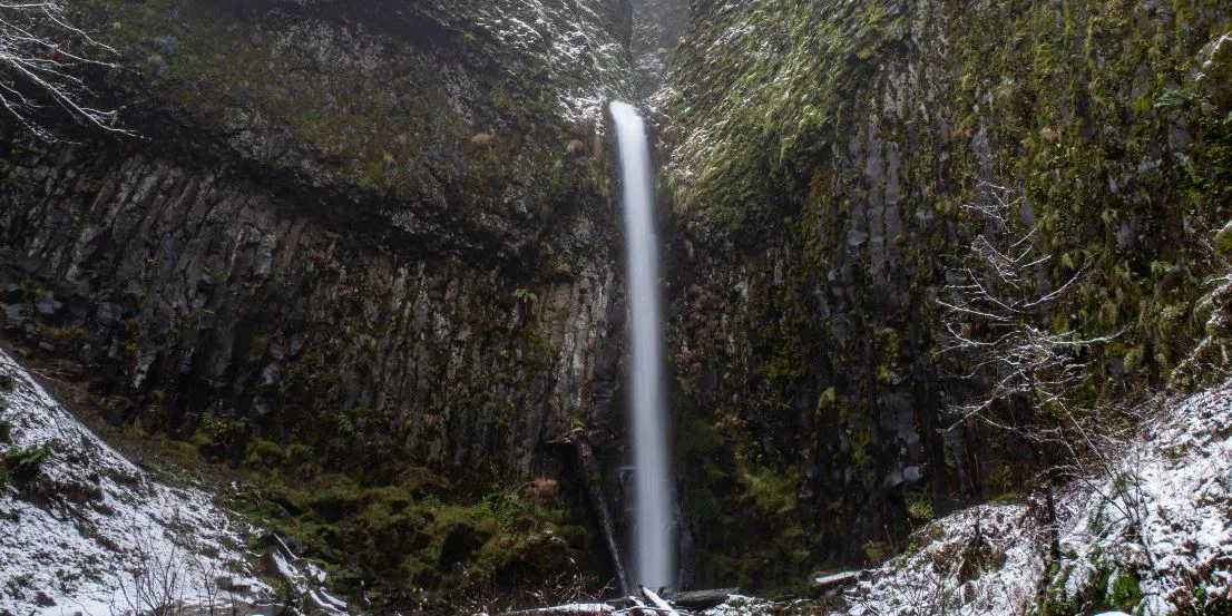
- From Toll House Park, cross the bridge approach road to the Pacific Crest Trail trailhead. For 400 feet, the PCT parallels I-84 until it intersects Moody Avenue. Turn right and walk uphill on Moody as it crosses under the freeway. In a few hundred feet, come to twin trailheads. On the right is Gorge Trail 400. Take the trail to the left, which is the PCT. It heads gradually uphill. About 1 mile in, come to a power line access road. Turn right on it, follow the road a short distance under the power lines, and turn left at the sign for the PCT to continue on the trail. Come to a minor summit, and the PCT begins a gradual descent to Dry Creek. At Dry Creek, the trail intersects a dirt road, Dry Creek Road. Turn right on it to walk to the base of the falls.
- Water from Dry Creek was used from 1896 to 1937 to power the lock chamber gates at Cascade Locks, the locks that gave the town its name. The locks were built to circumvent the great Cascades of the Columbia, a long whitewater expanse that was a major impediment to river travel. When the creek was used to power the locks, its creek bed ran dry; hence the name. When Bonneville Dam became operational in 1937, the Great Cascades, along with most of the lock canal, were submerged below the rising water behind it.
- Return via the same route or, for a loop, walk Dry Creek Road (which is closed to vehicle traffic) 2 miles to Ruckel Street. Turn left on it, pass under I-84, and follow city streets to Cascade Locks’ main street, WaNaPa Street. Turn left on it for ice cream, lunch, or a snack. Head west on WaNaPa Street to return to the start. The loop option is about 5 miles.
- Please always stay on the trail and clean your boots before and after you hike. Hikers and their dogs are common vectors for spreading invasive seeds.
- Restrooms, closed in winter, are at the trailhead.
Post-Hike Explorations
In town, visit Cascade Locks Marine Park. This riverfront park was once the base of lock operations by the U.S. Army Corps of Engineers. Explore the lock canal, with its hand-tooled basalt blocks, and walk a footbridge to Thunder Island. Interpretive displays tell the story of the site. In the park are three lock tender homes, in vintage U.S. Army Corps of Engineers style, each one aligned with a lock gate. Offshore lie the Great Cascades of the Columbia, now submerged. At very low water levels, a few rocky outcrops emerge from the river. Downstream is an excellent, in-river view of the Bridge of the Gods.
Directions & Travel Tips
On I-84, take exit 44/Cascade Locks and follow signs to the Bridge of the Gods/Stevenson. As the road circles uphill to the bridge’s tollbooth, turn right into wooded Toll House Park, which is the trailhead parking area.