On the Trail
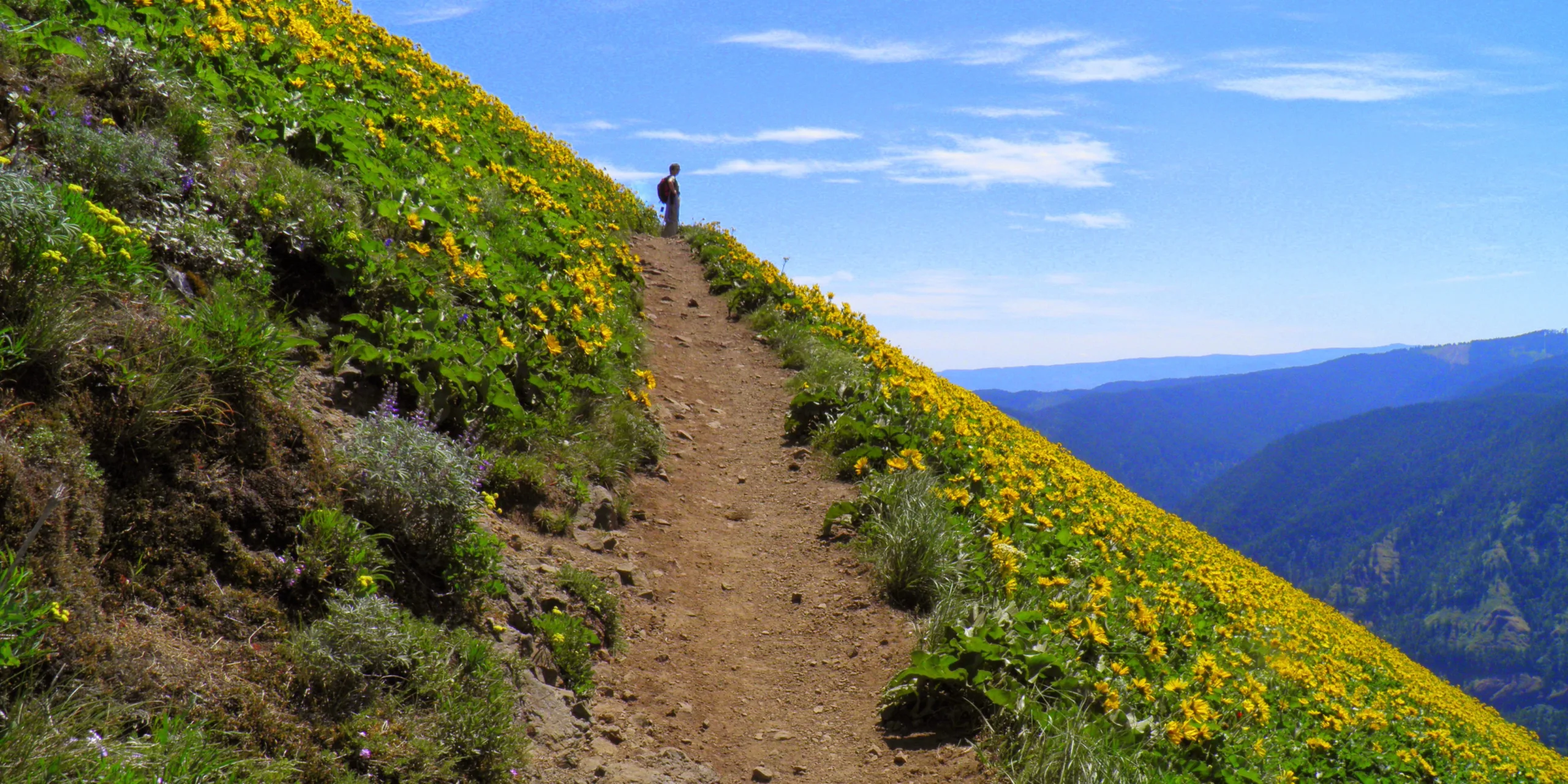
This 6.9-mile loop is extremely popular on weekends, especially during spring wildflower season (mid-April to mid-June) when Dog Mountain’s summit meadows are carpeted with balsamroot. The hike to the 2,948-foot peak gains 2,820 feet in elevation, and is strenuous. Views, both at your feet and in the distance, are spectacular.
Permits & Pets
To address the growing popularity of this trail, a permit system was launched in 2018 for Dog’s peak balsamroot bloom season, approximately April to June. On weekends during this window, hikers must obtain a permit one of two ways:
- Option 1: Obtain a hiker permit by riding the shuttle. For $2 round trip, ride Skamania County’s shuttle from Skamania County Fairgrounds and receive a hiker permit. Learn more.
- Option 2: Purchase a hiker permit online before you go.
The site is managed by the U.S. Forest Service. Forest Service employees will check hikers for permits at the trailhead. One ticket is required for each hiker. Carry a printed or electronic version of the permit with you. Purchasing the permit does not guarantee parking at the trailhead. Hiking permits are not required on weekdays.
In addition to the hiking permit during the peak season, a Northwest Forest Pass is required every day, year-round, to park at the trailhead. Day passes can be purchased at the trailhead with $5 cash or online.
We recommend always keeping your dog leashed to protect the sensitive landscape and respect other hikers.
Trail Notes
- From the trailhead, hike steeply through woods along the Dog Mountain Trail (Trail 147) for 0.7 mile to a junction. Stay on the trail to avoid poison oak. At the junction, an older version of the trail, signed “more difficult,” veers left, and a newer, “less difficult” trail is to the right. The older, steeper route has little to offer over the newer version. Follow the “less difficult” trail as it climbs 1.2 miles to the lower viewpoint.
- Continue up the trail another 0.5 mile to a junction where the old and new trails meet. The trail steepens, and the summit meadows can be seen through the trees. In late spring, the sight of the balsamroot is enough to power your legs another 0.5 mile to an old fire lookout, another spot to enjoy stunning views of the Oregon side of the Gorge.
- From here, two trails go to the top, creating a loop. The main trail continues to the left, toward a meadow notorious for being pummeled by high winds. In about 0.4 mile, come to a signed junction. Continue up, on the right-hand trail, to the Summit Loop Trail. At the top of the meadow, follow a short spur trail to a fire ring and flat area good for a snack and celebrating the end of the uphill walking. Mount Hood peeks over Mount Defiance in the south.
- Return via the same route, or continue southeast on the Summit Loop Trail into the woods and meet the main trail back down at Puppy Dog Lookout. This alternate is not as scenic, but is more sheltered and can be a good choice in poor weather. The trail also has a more stable walking surface with fewer loose rocks. From Puppy Dog Lookout, return via either “more” or “less” difficult routes to the trailhead.
- Please always stay on the trail and clean your boots before and after you hike. Hikers and their dogs are common vectors for spreading invasive seeds.
- Restrooms are at the trailhead.
Friends of the Columbia Gorge does not track trail closures. If you are planning a hike in the Gorge, please check other sources in advance for the latest updates, including the U.S Forest Service, Ready Set GOrge, and AllTrails. Recreational activities in the Gorge can involve risk of injury, death, property damage, and other dangers. Friends does not assume responsibility for any such outcome resulting from the use of the information on our hiking web pages. Your use of these web pages is strictly at your own risk.
Post-Hike Explorations
After the hike, drive SR 14 for 9 miles west into Stevenson, where many brewpubs will slake your powerful thirst. Soak your toes along Stevenson’s waterfront, at Bob’s Beach, Sailboard Park, or East Point.
Directions & Travel Tips
From the intersection of SR 14 and Wind River Highway, drive 6.3 miles east on SR 14 to the large Dog Mountain parking lot and trailhead on the north side of the highway (at milepost 53). When the parking lot is full, do not park along SR 14. Tickets are issued, and towing happens.
Car-free travel: A seasonal shuttle operates from Skamania County Fairgrounds in Stevenson, Washington, to the extremely popular Dog Mountain trailhead on weekends. View schedule and fare information.