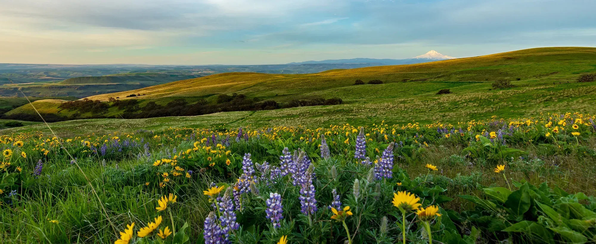
The Columbia Gorge is a place of unparalleled natural beauty with diverse wildlife, endangered salmon runs, five major ecosystems, 800 species of flowering plants, and rich cultural traditions. The National Scenic Area Act—the federal law that protects the bistate region—charged the U.S. Forest Service to protect and enhance federal lands and created the Columbia River Gorge Commission to protect and enhance the nonfederal lands in the 292,000 acres within the Scenic Area. These protections were due in no small part to the grassroots efforts of citizens around the Pacific Northwest, including those who founded Friends, to ensure future development in Gorge was responsibly managed.
When enacted in 1986, the Columbia River Gorge National Scenic Area Act required the development of a management plan that ensures the protection and enhancement of scenic, natural, cultural, and recreational resources. The management plan also must protect agricultural lands, forest lands, and open spaces. The original management plan was adopted in 1991 (and until the 2020 review had been reviewed only once in 25 years), although the law requires it to be reviewed at least once every ten years. Prior to the 2020 revision, most of the resource protection provisions of the plan were based on inventories, science, and policies that are more than 25 years old. View the current management plan as approved in 2020.
On Oct. 13, 2020, the Gorge Commission voted to adopt the revised Management Plan in a 9-2 vote. The revised plan includes climate policies, equity policies, strong urban area boundary policies, wetlands protections, doubled stream buffer size for salmon, improved scenic protection, limits on new dwellings in Forest zones, improved farm dwelling standards, stronger mining restrictions, and much more. The revised plan is not perfect, but it is substantially improved. These are the most sweeping policy changes since 1991 when the original management plan was adopted.
With the new updates to the management plan, the scenic, natural, cultural, and recreational resources of the Gorge will have greater protections, and Gorge residents will be afforded improved opportunities to enhance these important values. At the same time, the work is not complete. Now, the Gorge counties and the Gorge Commission must adopt new land use ordinances to implement the new management plan. Friends is working tirelessly to make sure that the land use ordinances are compliant with the much-improved management plan.
Sweeping Changes Passed in 2020
The plan revisions made in 2020 are the most extensive policy changes since the original management plan was adopted in 1991.
The revised plan, adopted on a 9-2 vote, will:
- Require the development of a climate action plan,
- Apply strong policies limiting urban expansion,
- Prohibit the destruction of wetlands,
- Double the size of protective stream buffers for critical salmon habitat,
- Improve development standards to protect scenic views,
- Limit new dwellings in Forest zones to reduce fire risks,
- Improve standards protecting agricultural lands,
- Expand mining restrictions, and
- Require the development of an equity lens to guide future decision-making.
Adopted in 1991, the current Scenic Area Management Plan has been reviewed only once in 29 years, although the law requires it to be reviewed at least once every 10 years. This means many key challenges the National Scenic Area faces today—from climate change impacts to limiting urban expansion—have not been adequately addressed.
Here are some of the highlights of the revised Management Plan:
- Climate: The Gorge Commission voted to include a new chapter in the management plan devoted to climate change and to require the development of a climate action plan.
- Salmon: Protective buffers limiting development have been expanded from 100 feet to 200 feet around “cold water refuge” streams for salmon. These streams identified by the federal Environmental Protection Agency include the Sandy River, Hood River, and Deschutes River in Oregon and the Wind River, Little White Salmon River, White Salmon River, and Klickitat River in Washington.
- Wetlands: The destruction of wetlands for development purposes is now prohibited. New development must avoid impacts on wetlands and their buffers.
- Urban Boundary Expansion: The National Scenic Area Act only allows minor expansions to urban area boundaries in the 13 designated urban areas in the Gorge. New policies will require regional analysis of buildable urban lands and place hard caps on the amount of land that can be added to urban area boundaries.
- Forest Dwellings: Recognizing the increased frequency and intensity of fires due to climate change, new dwellings in large-scale forest zones will be prohibited to help reduce the risks of fire and protect forests, human lives, and property.
- Agricultural Land: To prevent the conversion of agricultural lands to residential uses, stricter standards were adopted for new dwellings in farmland requiring proof of commercial-scale agricultural production prior to approval.
- Diversity, Equity, and Inclusion: A new chapter was added to the Management Plan recognizing the history of systemic racism in the region and requiring the development of an equity plan to help guide future decisions and ensure a more diverse makeup of the Gorge Commission.
Additional Resources
- Read the draft Gorge Management Plan and related Gorge Commission documents here.
- Read an analysis by The Columbian, including comments from Commissioner Robin Grimwade, here.
- Read a joint letter by leading NW conservation groups to the Gorge Commission with Scenic Area Management Plan Recommendations here.
Latest News

Friends of the Columbia Gorge Announces Gabe Sheoships as New Executive Director

Appeals court ruling sets stage for protection of western gray squirrel in Washington state