On the Trail
This beautiful out-and-back hike travels along Oneonta Creek and passes several waterfalls, ending at picturesque Triple Falls. It totals 3.2 miles, with 1,142 feet of gain. Alternatively, turn the hike into a 3.6-mile loop that passes more waterfalls, ending at Horsetail Falls on Horsetail Creek. The loop has 1,446 feet of gain. Another out-and-back alternative is, from Triple Falls, to hike farther along Oneonta Creek to make a 5.4-mile out-and-back hike with about 2,000 feet of gain.
Permits & Pets
The trail along Oneonta Creek is managed by the U.S. Forest Service. No permits are required. Dogs must be on leash.
Trail Notes
- The hike begins on the south side of the highway, across from the parking pullout. Begin climbing the Oneonta Trail (Trail 424). It parallels the old highway, then switches back at a junction with Gorge Trail 400, which heads west.
- Here, stay on Trail 424. About 0.5 mile from the start, a side trail to the left leads to viewpoints. Walk its half-circle loop, which leads back to the main trail. Continue on the trail, high above Oneonta Creek. At 0.8 mile, come to the junction with Horsetail Falls Trail (Trail 438).
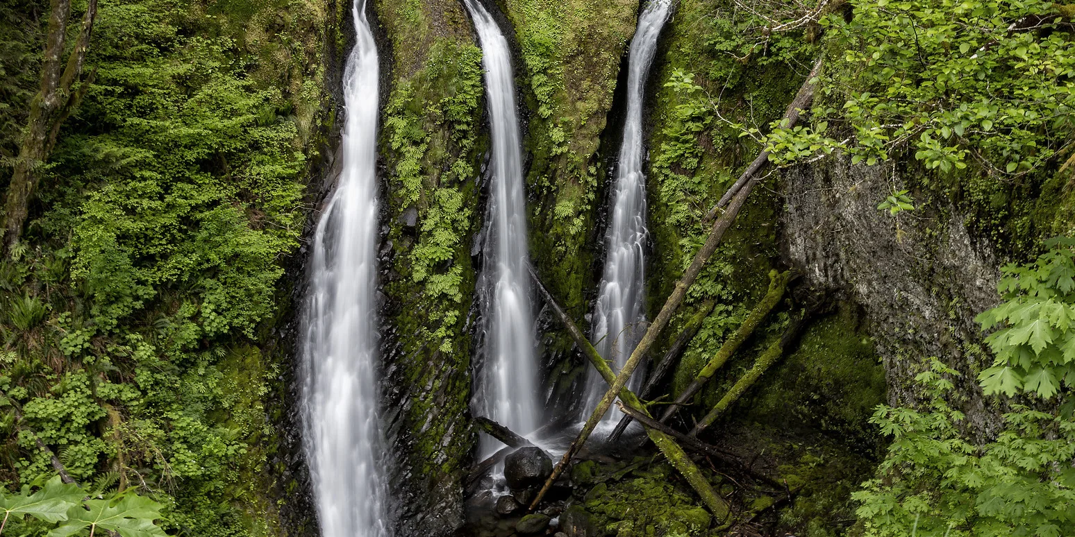
- Here (if you’re not planning to loop to Horsetail Falls later, as described below), detour onto Trail 438 for a 0.2-mile total, out-and-back look at Middle Oneonta Falls and Lower Oneonta Falls; a bridge crosses the creek between them.
- Come back up from the bridge to Trail 424 and continue south (left) along Oneonta Creek.
- Pass hard-to-see Upper Oneonta Falls. A sketchy trail angles down toward the falls, but the main trail stays well above the creek, along the side of the ridge.
- Come to a viewpoint of Triple Falls. Use caution here.
- Continue on the trail a short way to a bridge over Oneonta Creek, which makes a nice place for lunch or splashing in the creek.
- To extend the hike along an especially scenic section of Oneonta Creek, after crossing the bridge, continue on Trail 424 another 1.1 miles one way, climbing 840 feet, to a junction with Horsetail Creek Trail (Trail 425).
- Retrace your steps to the start. Or, at the junction with Horsetail Falls Trail, turn right and walk by Ponytail and Horsetail Falls. Return to the trailhead with a 0.5-mile walk along the Historic Highway (Note: Please exercise caution anytime when walking along the Historic Highway and be traffic aware).
- Please always stay on the trail and clean your boots before and after you hike. Hikers are a common vector for spreading invasive seeds.
- There are no restrooms at the trailhead.
Friends of the Columbia Gorge does not track trail closures. If you are planning a hike in the Gorge, please check other sources in advance for the latest updates, including the U.S Forest Service, Ready Set GOrge, and AllTrails. Recreational activities in the Gorge can involve risk of injury, death, property damage, and other dangers. Friends does not assume responsibility for any such outcome resulting from the use of the information on our hiking web pages. Your use of these web pages is strictly at your own risk.
Directions & Travel Tips
Eastbound I-84: Take exit 28/Bridal Veil. At the top of Bridal Veil Road, turn left on the Historic Columbia River Highway, and drive 5 miles to the parking pullout on the left, at the Oneonta trailhead. Westbound I-84: Take exit 35/Ainsworth, and drive 2 miles west on the Historic Highway to the parking pullout. There are no restrooms at the trailhead.